Route Description
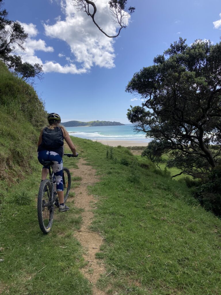
The Whananaki Coastal Walkway is a gravel track with some grass and clay surfacing at the northern end. It can be ridden one way or as a return trip. There are stunning views, but the shade is limited. In warm weather, bring your swimwear for a cool plunge either en route or at either end.
If riding from south to north, you will start at Sandy Bay. Either drive to the end of the gravel road or park at the beach and ride up the short climb to the gate.
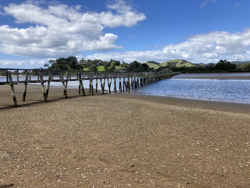
The trail includes several climbs following the contour around some farmland, and up through regenerating manuka. Cows are regularly on the track, so stay in control and watch your speed. At low tide, you can ride around the coast to the footbridge. If you would rather avoid the sand and saltwater, turn left on the gravel road at the fork before you hit the estuary and ride along that road for a short detour over the rise, turn right, and the road ends at the entrance to the iconic Whananaki footbridge, the longest in the Southern Hemisphere. The bridge is very narrow. You can ride if you are careful, but passing is only possible at the two passing bays located partway along the bridge. It is not suitable for tandems or trikes.
From here you can cross to the local store and return by road or back the way you came (the more pleasant riding option).
To access the Bougainville Memorial, you need to follow the coast south from the Carpark at the Whananki end (at low tide only) and walk along the beach to the far end. A steep path rises up to the monument. More information can be found On the Whangarei District Council website
Distance: Approximately 8 km each way
Surface: Gravel road, grass track, mud and slippery in the wet.
Time: 1-2 hours each way
Level: Moderate (Advanced in wet conditions)
Suitable for: MTB, eBikes, and walkers. The walkway has several locked gates across the path, which are quite high, and you have to lift your bikes over. This can be very difficult on your own, especially if you have an eBike, please make sure you have a biking companion with you.
Note: This walkway forms part of the Te Araroa Trail, so look out for walkers, especially from October to February.